

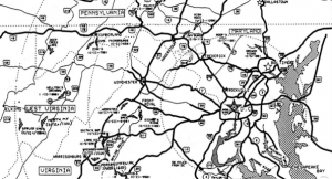
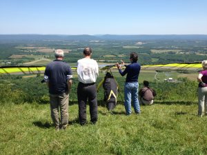
Sites & Weather
If you’re new to the area, check out our New Pilot Orientation.
Learn how to decide if it will be flyable.
Members-Only: Google Map and Google Docs containing up-to-date LZ status and carpool meeting spots.

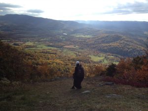
Edith’s Gap – Site Guide – Club Live Weather Station
Quickly becoming our most used site and probably the best for XC options. SE ridge that heats up early in the morning. Soaring can start as early as 1030am in the summer. The landing zone is tricky due to downslope and power lines and requires a very careful approach. Please seek a site intro. It’s too small for hang gliders, though it has been done at least once (downwind/uphill!).
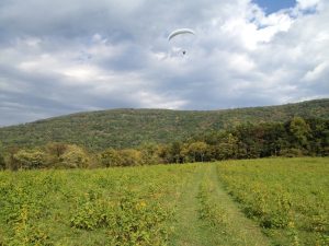
Woodstock – Site Guide – Club Live Weather Station
NW ridge. Not good in a W cross due to spine to the left of launch. Winds are typically lighter than forecast, but with strong thermal activity that will be the opposite. We often get Wave lift here in the Winter. The bridge field is planted in crops in the summer. Check the google site guide for status.
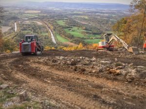
Woodstock underwent MAJOR renovation to complete revamp and expand launch thanks to Patrick Terry’s multi-year long effort. Construction totalled $40k! Half was paid for with membership dues and the other half was a grant from the Foundation for Free Flight. Please become a member to support projects like this! Videos and pictures of the construction are on facebook.
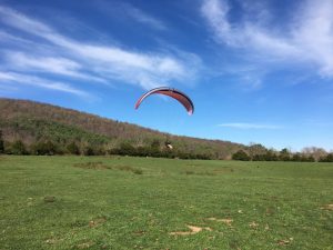
Pulpit – Site Guide – Club Live Weather Station
NW ridge, but launch faces W. Difficult in a N cross. Venturi at launch causes actual winds to be higher than forecast. Paragliders typically don’t go if it’s forecast to be over 7mph.
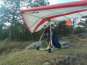
Launch is owned by the CHGPA and has two wooden (HG) ramps with a gravel PG launch slope between the ramps. Camping is allowed on launch as we own the site. Secondary landing zone is planted in crops in the summer. Please be very considerate of our neighbors at this site. Drive slow on the launch and LZ roads, and be a good steward of the site. When you fly here, PLEASE MAKE SURE to print your parking placard (available in the Members section of the website) before you go, and leave it on your dash while parked at launch.
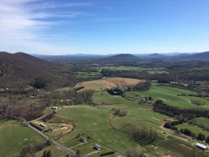
Dickey Ridge – Site Guide – Weather
SW ridge inside the Shenandoah National Park. One of the only paragliding and hang gliding sites on National Park land in the United States! Requires P3/H3 with Cliff Launch and Special Use Permit. Additional sites in the SNP, Hog Back (N) and Millers Head (SW) are pending NPS approval and would become our highest sites – hopefully in 2017!
Daniels – Site Guide – Weather
Faces SSW. Not good in a West cross. Daniels also has a weather station close by called Little Edge Farm that’s good for hourly observations.

Bill’s Hill – Site Guide – Weather
The site is now open for 2023! Please contact the landowner to confirm a landing zone(s) is open and not in crops. Also requires notifying the Buchanan State Forest prior to flying (717) 485-3148.
East facing ridge. Top landable by paragliders.
PA DNR Maps show locations of some of our flying sites!
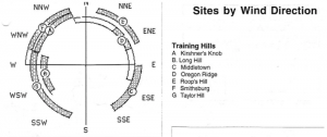
TRAINING HILLS
Smithsburg – Site Guide – Weather
NW training hill, but closed in the summer for crops
Taylor Farm – Site Guide – Weather
SW training hill – requires waiver before flying
Long Hill – Site Guide – Weather
W training hill – requires landowner notification
Kirshner’s Knob – Site Guide – Weather
W and N training hill
COMING BACK SOON
The following sites are temporarily closed but will be re-opening in 2024. Once the site guides are completed and the sites are formally re-opened, the links will be posted here.
- High Rock (HG Only)
CLOSED SITES
CHGPA no longer maintains and insures these sites due to maintenance issues, difficulty of access, or because more suitable sites exist.
- Hog Back (PG Only)
- Miller’s Head
- Fisher Road (no longer maintained and no LZ permissions)
- Flattop (no acceptable LZ)
- Spruce Knob
- Oregon Ridge (Training Hill)
- Hains Point (Kiting Area)
REGIONAL WEATHER
Short Range Forecast – high pressure and post frontal are best
Windmapper – regional surface wind direction/strength conditions and forecasts
NoStepper – hourly winds aloft forecasts for all of our sites, including radar and satellite loops, and thermal blip map
Winds Aloft – always check winds aloft at 3k feet to see if there’s any strong winds at altitude. Paragliders typically don’t fly when the forecast is 15-20kt at 3k feet.
Area Forecast Discussion – text forecast