Capitol Hang Glider
Association


|
| July/Aug 2001 | Volume 39, Issue 7 | |||||||||||||||||||||||||||||||||||||||||||||||||||
|
The September meeting of the CHGA is Wednesday, the 26th at 8:00pm
 Late Breaking News:
Pulpit Fly-In Rescheduled for October 6-7, 2001
Pitch in now! Call Carlos to volunteer Fly-In Info Central See articles in this issue: Flying the Pulpit Pulpit Approaches The Capitol Hang Glider Association meets on the fourth Wednesday of every month. Meetings are held downstairs at Lasick's Beef House. Directions: 0.8 mile inside the beltway on Route 1 South, just past the Super 8 Motel (College Park exit off I-495). Note: If coming from points north on I-95, at the Capitol Beltway stay right at the split and then take the immediate left exit to Route 1 South, College Park.
Lasick's Beef House 9128 Baltimore Blvd. College Park MD 20740 (301) 441-2040 GPS log of Mike's Excellent Adventure
)
Click for large view About GPS track logs: The line in the map picture shows about the last 45 minutes of the flight. How long and how detailed a track log the GPS saves depends on the settings and how many track log points it can save. Mine only has 768 points, most newer models have more. I use a Garmin 45 on the automatic setting, in that setting it saves more points the more you turn and fewer when going in a straight line. It can also be set for a certain time interval. Had I set it for 15 or 20 second intervals it would have kept a track log all the way back to Ridgley. Most of the GPS's we use were designed with boating or driving in mind, not the soaring pilot. You can view your track logs on the tiny screen of your GPS, better yet to view and save them on your computer. I use MacGPS Pro, there are others out there like TopoZone and Garmin's own program. With such programs you can overlay your track log onto a map. |
Mike's Excellent Adventure Mike Chevalier
Here's the story... Cracking 50, Finally. Saturday, June 9th. The forecast looks good for the Pulpit or Ridgely with light NW winds predicted. I decide to go to Ridgely and sleep late. Steve Padgett shows up, we finally leave about 11:30. I really chomp the bit on the drive as conditions are looking great. By the time I launch, the blue hole is approaching and – wouldn't you know – the weak link breaks at 300 ft. I pull off a perfect no stepper right where I launched from, tie up another weak link and put the glider on the cart again. By this time I'm really Jonesing and I have to wait for a tandem flight, tug refuel and pilot pit stop. About 20 agonizing minutes go by as I hear Joe Gregor on the radio reporting being at 7000 ft and climbing.  The tow is bumpy but uneventful, after releasing I only find light thermals. As I feared, I'm a little too late and may have "missed the train". I eventually top out at 4450 and head downwind trying to catch the better looking clouds. No more thermals to be found, I hit big sink and land along route 317 east of Denton for a measly 8.9 miles. I relay my location to Steve with the help of another pilot still flying and he shows up in an hour. Conditions are too rough for tandems so Steve has to wait. In the meantime I find out that several pilots launching earlier landed near the coast as far as Ocean City. I leave Ridgely that evening bound and determined to return earlier the next day. Back home I hear of multiple valley crossings from the Pulpit and that it didn't turn on until after 2 PM so I could have gone there. I get up earlier on Sunday with the help of the alarm clock and hit the road. 12:30 I'm set up and ready to go, the sky doesn't look as promising as on Saturday. Wind is very light and some pilots sink out. I dress for altitude which could be my undoing and launch at 1:30. 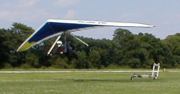 After a slow climb to 4500 I head downwind towards Denton. A couple other pilots nearby glide back to the field, leaving me on my own, I was hoping to have company. Passing north of Denton I hit big sink in the same area as yesterday and worry that this may be another short one. Down to 1200, I spot circling Redtails and make a bee line. It pays off and I'm back to 2200 but it's short lived. I spend the next 20+ miles struggling between 900 and 2000 ft, at one point getting the pod zipper partially open and ready to land. No streets today, I'm saved several times by the birds and also find that trailer parks are good sources of lift. Better yet are birds over trailer parks.
 Conditions improve when I reach Bridgeville, I find a thermal that takes me to 3200 ft. The thermals are consistently better after that, a good thing as I am afforded a good look around. I pass over a large wooded, swampy area and a lake. Approaching Georgetown, I get the best thermal of the day and climb to 6K in a blue thermal. Most of the thermals so far have been blue. As I near 6K, I hear the drone of an engine, as it nears it slows down and a small plane comes in for a close look. I wave and get a wing wave in response from the Cessna. I should be thrilled, this is obviously going to be my longest XC from Ridgely but I'm worried. How the Hell am I going to get back? The radio has been silent although I check once in a while. Talked to Joe and another pilot from around Denton but nothing since. Some had gone to another frequency. There may be other pilots nearby but I just don't know. 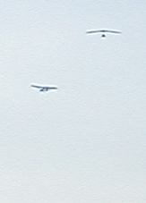 Up ahead I can see a big triangle and soon realize that it's Georgetown airport. I had checked the sectional and talked to other pilots about it and knew that it was an uncontrolled airport. Many other pilots have flown over and near it. But you don't expect an uncontrolled airport to have mile long runways laid out in a triangle. And as I get closer I can see lots of heavy iron parked down there but only a small plane takes off. I pass just to the south of it at 4K.
 There are clouds now, running north and south and the drift is much more from the north than before, I turn south and parallel route 113. By now I'm thirsty, my Platypus broke last fall and I still hadn't replaced it. Lift is everywhere, this must be the coastal convergence I've heard of. A few 360s and I follow 113 without turning, watching the GPS clock the miles. Lewes and Rehoboth beach are easily recognizable. I can see the Indian River Bay where I used to clam, fish and boat. Long ago, in a different life, I used to live there, near Ocean View. I haven't been back in decades. I recognize Indian River Inlet but what's that just to the south? Bethany Beach? It looks like Atlantic City now, I remember it when there were no high rise buildings. I recognize Dagsboro. The school bus was so on time everyday that when we passed through that town the radio was always playing "I Went to a Garden Party". Passing over the next big town, I'm joined in the lift by chicken feathers. Next to the school I attended in Selbyville was H & H Poultry, a rendering plant. Feathers would often float in through the classroom windows along with the stink. It must be still there. By now I'm parched and the GPS has cracked 50 miles from Ridgely and it's time to land. I've been avoiding the lift and am down to 600 ft. Pick out a field next to a housing development, yell to the barbeque party and attract their attention. Get over the field and wouldn't you know, 800 fpm up, stadium size. No way I can land there. How obscene, so much of the flight is a struggle to find lift, now that I don't want it I can't avoid it. Crank a few turns and I'm back to 2K and down the road to look for someplace without a thermal. Another mile or so and I've got another field picked out. Drift is light and out of the NNW. At 100 ft. I turn on final and realize I'm going downwind. A quick 180 and I pull off a no stepper in a back yard at the intersection of 113 and Jarvis Rd. Airtime, 3.5 hours, 52.1 miles. The wind on the ground is light SE. A couple and son come out, they are thrilled to have me and bring out drinks. Before I can speak I have to dig out the bottle of Gatorade and down it. They take some pictures with a Polaroid, the son wants to take them to school for show and tell. The husband saw 2 gliders in the area the day before, must have been Fred and Joe. I call back to Highland and get Tad to come and retrieve me. Then I call the pilots who had gone to the Pulpit that day, they had not had as good a day as on Saturday. Spend the next hour and a half talking to the husband, he was extolling the virtues of his Ford Ranger truck in which he had been involved in a 60 mph head on crash. Somehow I think his speed was exaggerated. photos by Judy McCarty
|
|
||||||||||||||||||||||||||||||||||||||||||||||||||