Capitol Hang Glider
Association


|
| Oct 2001 | Volume 39, Issue 9 | ||||||||||||||||||||||||||||||||||||||||||
|
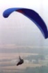
Bill Eats Milesby Bill BuffamDreaming the dream There's this field on Sugartown Road in Malvern, owned by Devereux. I drive past it frequently on my way to work. Ever since I heard Jeff Harper's story about flying home from the Sac, I've been thinking "some day I'm going to land in that field." Every time I drive past it, I see myself setting up an approach and making a perfect landing, to the total astonishment of passers by. So the booming forecast for Friday (June 8) got me thinking I could give it a shot. Work got in the way a bit, so in deference to my job (it provides food and shelter after all) I decided to wait until Saturday, which was looking even better on the forecasts. Making the dream come true I persuaded the ever-eager Lenko that we should leave Reading at 6 a.m. The plan was for him to get a few flights before it started to turn on. Then he could drive retrieve for me. He got a couple of sleds, and I launched just before noon. Gained 300 feet and thought "I'm on my way!" 5 minutes later I was in the LZ, feeling humble. Back at launch some cumies started to roll in, and things were looking better. The wind was picking up a bit too, though not strong or consistent enough for reliable ridge lift. After waiting 20 minutes or more for a decent-looking cloud to come over I decided it wasn't going to happen, so I launched to chase a ratty-looking cloud. My sink alarm groaned at me while I was still in the slot! Not a happy sound. But I worked whatever I could find - some ridge lift, some thermal, until I found a semi-coherent core on the South (and therefore sunny) side of the mountain. Over the back: a career first I never really made a conscious decision to go over the back. For a while I had both options open: I could get back out front or I could run downwind and land in the valley. The wind was under 5 mph most of the time, and coming from the NW. Anyway, I stayed with the thermal, drifting back over Route 25. It was a vaguely defined thermal meandering around and going gently up at 100 fpm or so, and it topped out at 3000'. (I'm talking MSL here with all my numbers.) I was now starting to sink, and was looking to land. But I flew hopefully towards the next ridge to the South. The Sac XC nemesis: Tower City suck So there I was picking out a place to land when I stumbled into the next one. Worked it with the drift over the next ridge up to 5800', within a whisker of my personal-best gain. By this time I had Tower City (officially Muir) in view and in glide range. The thermal laughed as it ran away, leaving me to fly out into the valley, where my sink alarm started a prolonged groan. I flew crosswind looking for something, anything, but nothing was happening. Down to 2500' the fields were starting to look big. I flew around trying to decide which one would be easiest to describe to Lenko. When I stumbled into the next elevator. A steady 500 fpm, nicely organized and gentle. It took me all the way to 7800' , breaking my previous personal best by 700'. I flew over the I81/Route 443 junction, where Lenko and I had stopped 8 hours earlier for a greasy McBreakfast, and headed towards 501. Oceans of sink Now my sink alarm was having a serious groaning fit. The sink was unbelievable - very large areas that took 10 minutes of tight VG and careful attention to speed-to-fly to get through. I was down to 2500' at the base of the North side of the ridge, alongside Route 501, and seriously evaluating landing fields - again. And again, I stumbled into the next thermal up. The best bit This section was maybe the most enjoyable part of the ride. It was totally neat to look down on our 501 launch site from 4 or 5k'. The campground looked tiny. Actually, it wasn't as tiny as I would have liked; I was losing it . But I flew on, confident now that I'd find something downwind. It was all flat ahead and the cumies were plentiful. Sure enough I picked up another ride, right around Judy's field. The field was right below me, complete with horses wandering around where we land. I passed over all the familiar ground on the way to Ron's field at the bottom of 501, still circling in the same thermal. I was at the I78/501 interchange before the thermal topped out. Continuing South, I recognized the blinker at Route 419 and Shaefferstown Road. Now where to head for? I was in the flats now, with no familiar mountain reference points to show the way. Gadget man defends his geekiness Here's where preparation comes in. I started off telling you about the field I wanted to land in, the one I pass on the way to work. Well, because I've been thinking about making this trip for so long, I've been actively planning it too. I have a complete route all ready loaded in my GPS. It's been in there for a couple of years. After the 501 LZ (Ron's field), the next point I picked for my route was Wernersville. Why Wernersville? Well, it looked like it was far enough from the Reading urban sprawl, and it was on my way to Sugartown Road. The Garmin GPS is great. You put a route in there, consisting of your list of waypoints, and the GPS gives you a pointer that tells you where to go (it's fun watching the arrow spin around when you're working a thermal!). It's smart enough to figure out which is your next waypoint. The routes are directional, so it knows which way you're going, and having selected the route segment, it points you at the waypoint at the end of that segment. If you fly near but not to a waypoint, it's no big deal - once you're past the waypoint, the next route segment becomes the closest one, so the arrow points you where you want to go. Dodging people and trees So there I am heading towards Wernersville. Well, the Wernersville area looks quite a bit more developed than my Delorme Gazetteer would have me believe. I had to fly West of Wernersville to stay out of all the housing developments and generally unlandable terrain. My sink alarm had been groaning most of the way from I78, and I was getting low. There was a formidable barrier of trees ahead of me. I couldn't see good landing options over the trees, and would barely be able to make it anyway. I started picking out landing fields. (Does this sound familiar?) There were some okay options, but with the crops starting to come through, there was no obvious best choice. Once again I was picking fields, sinking all the while. My choice looked grassy, but there were some patches of bushes and things that looked eminently avoidable. I couldn't really decide whether it was downhill or not, but eventually I decided it was flat or nearly so. Down to 1800', I unzipped, and stretched my legs after a long flight. I went to the upwind side of the field and boated around to lose altitude. And - caught the next ride. At first I thought it was just a random bubble, but I stayed with it for 1800' in 9 minutes (200 fpm). I caught another one almost immediately, going to 5000' and drifting back over the aforementioned "formidable barrier of trees," which now looked like an unremarkable patch of weeds from the security of 5k'. I flew towards my next waypoint, which was towards the South. I ran into another sink desert taking me down to 3k' , then caught the next cloud back to 5k' . After another prolonged groan from my sink alarm I caught the day's best ride to 8700', in the neighborhood of the Morgantown Interchange of the PA Turnpike. By this time there wasn't much wind, so I wasn't drifting much. You know, it gets seriously cold at 8700'. I'd reached cloudbase for the second time. Mindful of Weathermeister Keller's warnings of possible cloud suck, I kept a watchful eye on the cloud. I found myself heading for the downwind corner of it, just as had happened on the last ride to cloudbase. It seems the clouds were building on the downwind side and dissipating on the upwind side. Anyway, there was no sucking going on, and I was able to get out from under the cloud with no difficulty. Man, it's cold up there! Maybe it's my imagination, but it seemed like there was a quantum dip in temperature at around 7k'. I was quite comfortable for most of the flight, but above 7k' I was distinctly chilly. On an 80° day I wore a thermal undershirt, long-sleeved T shirt, and ski jacket. At no time did I overheat. Above 7k' I was cold and wishing I had my gloves. I didn't think to read my thermometer (yes, my flight toy has that!), but I'm guessing mid 30s. It wasn't really a problem, because as you see from the barograph I didn't spend a whole lot of time up there, though the spell above 7k' at Morgantown was 20 minutes. Company in the air As I circled above Morgantown, a sailplane flew around, thousands of feet below. Earlier, West of Reading, a twinengine plane had flown directly under me, several thousand feet lower. I saw a couple more light aircraft also. From Morgantown, I headed pretty well straight down the Turnpike, keeping to the North side. Why the North side? Here's the thing. A couple of planes came past heading East. BIG planes. Commercial airliners. Obviously headed for Philadelphia International (PHL). They were maybe a thousand feet higher (not much more, and probably less - I was at 8k' over Morgantown), and maybe 2 or 3 miles South. Too close for complacency, but far enough away to avoid brown trousers. Oddly enough, I saw no more airliners. There were two in quick succession, then no more. Coincidence? Anyway, I stayed to the North. My next and final waypoint was my field on Sugartown Road. My vario was telling me I needed to climb to make it. More on gadgets (as opposed to moron gadgets) Now let me tell you about my neat gadget. You tell it the grid reference of your waypoint (actually, the GPS does that), and the altitude of the waypoint, and the gizmo (a Brauniger IQ/Competition GPS, to use its proper name) tells you whether you can get there or not. It does its calculations based on the performance curve of the glider, the sink rate of the air, and the wind speed and direction (which it calculates, since it knows airspeed, and the GPS tells it the path over the ground). Is that terminally cool, or what? Yeah, I know this is old hat to competition pilots, but I still think it's really cool. Dealing with Class B airspace I get to the Downingtown Turnpike Interchange at Eagle. For the first time in my life I've traveled from one interchange to the next and not had to pay the toll. But now I have a problem. PHL controlled airspace starts at Lionville. I'm at 4.5k'. I have to get down to 3k' to be legal. More to the point, I have to be down to 3k' to avoid a close encounter with those large metal objects. So I stuff the bar, make a couple of 360s, and get down to a reasonable approximation of 3k'. Then I continue on my way towards Sugartown Road. The terrain below is looking pretty built up. I'm totally surprised by how hard it is to recognize stuff from the air. Finding stuff from the air in the mountains was easy. Now, in my own back yard, recognizing stuff is very difficult. This strikes me as crazy. But on reflection, it makes a lot of sense. The terrain in the mountains is stuff we're used to seeing from an aerial perspective. The mountains themselves form unmistakable reference points. The road patterns are very distinctive. In contrast, when you're flying above a neighborhood, you see a different perspective. You're not used to seeing it from the air. Also, while flying over, you're mainly thinking in terms of landing fields, so using brain cycles to figure out what is this building, or that street, is a luxury you really can't afford. So the most reliable reference point I picked up after leaving Eagle was the radio mast on the North Valley Hills ridge. Knowing where I was, allowed me to recognize Great Valley High School - which both my daughters attended for 4 years - and Bryn Erin townhouses, where I used to live. I flew on towards my goal, crossing Route 30 but failing to recognize anything, in spite of passing directly over my hairdresser's shop! Actually, I noticed around this time that the Philadelphia skyline had come into view - and quite magnificent it was too, about 20 miles distant. But I was getting concerned. Don't tell me I've made it this far, within 5 miles of goal, and now I'm not going to make it! My vario really couldn't make up its mind: "you've got it made with 200' to spare", "oops, you need to climb 100'", "you've got it made, but only just," and so on. All the time I'm getting lower, and the landing fields are fewer and fewer. Finally I'm down to one landing field. Surely I'll see Sugartown Road before I have to use this bailout? The voices It's at times like that when you start having dark thoughts. "Pilot makes flight of his life, but crash lands and dies at the end of it." In your head, you hear Bill Bryden's sober accident-analysis report: "The pilot had recently gained his H4 rating, but had limited cross-country experience. What we can all learn from this tragic accident is blah blah blah blah blah." I'm sure we all have these kinds of thoughts. Sorry if I'm breaking any of the rules by saying them out loud. Onwards to goal Well, I never did see Sugartown Road. I was down to 1600', with only the one field as a landing option. My vario was still saying I maybe, just maybe, could make it, but not having the field in view made it a non-option. I set about seriously evaluating the big field. The problem with it was that it had a distinct slope. Landing into the wind was not an option. It had to be uphill downwind. Using all the available space, I turned onto final at about 70'. That's about when I saw it - the tall tall grass. My thinking at this point was along the lines "oh shit!" Well, I'm a big reader, so I've read all the theory. I'm a listener too, and I well remember Christian's tall grass story, and Rich Green's recounting of New England landings in tall stuff. But tall stuff and downwind? Okay, new H4, you can do this. Just keep it fast, keep that basetube out of the weeds, flare early, flare hard, and parachute in. Well, I got everything right except the parachute-in part. These high-performance gliders don't parachute well, and I probably did a less-than-stellar job of holding the flare (memo to self: get some camcorder film of my flare action and fix this problem). Anyway, I zoomed and pounded in, breaking a downtube. No damage to body. Analyzing what went wrong So why didn't I make Sugartown Road? Actually, there were two separate errors on my part. I thought I was well prepared for this trip. After all, I'd been thinking about it for a couple of years. I had waypoints in my GPS. What I hadn't adequately prepared was the stuff in my own memory. Remember I said I had to get down below 3k' to avoid PHL controlled airspace? Bzzzzzzzzt. I only needed to be below 4k' at that point. 3k' starts around Paoli. So I wasted a precious 1k', which would easily have allowed me to make goal. I even flew through a thermal at 3k', [17] which I had to blow through, thinking it would make me illegal. And the second error? I'd screwed up the waypoint calculation for my goal on Sugartown Road. When calculating longitude, I must have subtracted from the map grid rather than adding to it. (You add as you move left, which is a little counterintuitive for most of us, who normally operate in left-to-right mode.) So I was aiming for a point over a mile beyond my goal. As luck would have it, I would have passed over goal. But the point here is that, even with my faulty memory of the airspace rules and my waste of 1000', my altitude would have gotten me to goal if I'd calculated the damn waypoint properly! Anyway, an important corollary here is get your waypoints right! Yes, well duh, but given that we're human, we need a backup in case they're not right. So validate the waypoint on the ground before you rely on it from the air, or if for any reason you can't do that, then keep a bailout landing field within reach just in case your goal waypoint is wrong. As a matter of fact, keeping a bailout in range really should be mandatory anyway. For all I know, I could have squeaked over the trees into my Sugartown Road field only to find a fairground or carnival or who-knows-what going on. Then what would I have done? I actually landed at N 40° 01.378' W 75° 31.775' In English, that's 730 Monument Road, Malvern. A mere 1.5 miles from goal. The Sac launch is at N 40° 39.585' W 76° 36.344'. If you do the math (hint: use a GPS), that's 71.8 miles. The field is totally surrounded by trees and a couple of houses, with no roads visible nearby, and no visible means of access. I didn't know how the heck I was going to get out of there. To summarize the what-went-wrong aspects here, what I neglected was that last ounce of preparation, that overkill anal-retentive attention to the last detail. I didn't do it (I think - I'm psychoanalyzing myself here) because I really didn't think I'd pull this trip off, so it really didn't matter if I hadn't planned it to the last detail. Analyzing what went right I know you guys like to give me a hard time about all my expensive fancy gadgets and my obsessive mathematical analysis, but let me tell you, the gadgets, calculations, and experiments really paid off big. I'd spent an entire calm morning at Ridgely test flying and measuring my glider's performance, and I have all the parameters loaded into my vario. It was absolutely invaluable. While I was flying through oceans of sink, I had the comforting (in the circumstances) knowledge that I was flying the optimum speed to get me through it. What's more, I knew I had to get my head down - that's really important, as my Ridgely measurements starkly showed. The sink was severe enough that 40mph was sometimes needed for best over-the-ground glide. And my glider won't even go 40mph unless the VG is full tight and I'm head down. Planning the route and loading it into the GPS was also invaluable. I probably could have found my way to Lionville (Downingtown Turnpike interchange), but it sure was nice not having to spend brain cycles on that. And once I hit Lionville I would have had to land. Figuring out the direction to fly as well as continuously evaluating landing fields would have overloaded my meager brain capacity. Meeting the neighbors As I was fiddling with my gear, a voice greeted me from behind, scaring me out of my skin. It was the landowner, Bill Lucas, and he was totally astonished that anyone could fly a hang glider so far. He was really friendly and helpful. Said he'd always wanted to fly, and seemed excited when I told him about Ridgely. Perhaps Sunny and Chad will soon see him down there. Anyway, we eventually got Lenko vectored in for the final act of the retrieve. Lenko did a magnificent job chasing. Broken gliders and tall grass Extracting a glider through 200 yards of 3 ft. high grass and weeds is no mean feat at the best of times. Add a broken downtube and it becomes a real epic. Thanks to Lenko's engineering virtuosity, we made the glider somewhat maneuverable with duct tape and the spine from my fin (memo to self: straighten spine from fin before next towing day). [Whatever would we do without duct tape?] Photography - or not, as the case may be I took lots of photos on the trip. Yeah right! I actually tried to. I was prepared enough to mount the camera, set it up, and aim it. But the damn thing turns itself off after 20 minutes of inactivity. My uncharacteristic launch potatoing, added to the desperate survival struggle for the first five minutes of the flight, meant that the camera turned off before I took even one picture. The Oscar acceptance speech Lenko Kovach, my friend and partner, did a sterling job on retrieve. Not only that, he sacrificed a shot at evening magic to come and chase me. Now, one shot at evening magic may not be such a big deal for us crusty old Hang 4's (cough cough - my H4 rating was just reaching its one-week anniversary at about the time I was whacking in), but Lenko is an H2 with only a handful of high flights, with only one being over 45 minutes. So for him it was a sacrifice. And he didn't even mention it. What a guy! Thanks also to Jim Keller, our Weathermeister, for raising the alarm on the impending boo-wah conditions. So, how was it - really? Okay, I've spent a few minutes back there moaning about the things that went wrong. But really it's more a case of taking care to learn what we can from my experiences. Really, the failure to make goal, and especially the broken downtube, are really really minor negative nits on what was a totally awesome, mind-blowing experience. I'm still trying to totally convince myself that I didn't dream the whole thing. It really was that great. Up to this flight, my longest XC had been 14.7 miles. To further put this experience in perspective, let me compare it with my first high flight. Now that was a mind-blowing experience. Soared for 50 minutes in ridge lift after 197 training hill flights - none longer than 40 seconds - stretched over 20 months. On a scale of 0-10, I would have ranked that experience, at the time, a solid 9.0. Now, in light of this latest flight, I rate this XC experience as a 9.7. In retrospect, I would have to downgrade the First Altitude Flight to a 7.0 to get the scale back into calibration. That's how awesome this flight was. Also very satisfying were all the congratulations pouring in through e-mail and phone as the news spread. You guys seemed as thrilled as I was. It was a wonderful feeling. What other sport has such supportive (as opposed to jealous and competitive) participants? None that I've been involved in. You guys are really, really terrific. And, finding challenge in adversity here, my goal of landing on Sugartown Road is still there as an open challenge, and now I know it's doable! Man, I love this sport! |
|
|||||||||||||||||||||||||||||||||||||||||